
Quick Answer for Gulf Visitors
Where does Turkey sit on the map? At the junction of Europe and Asia: 97% of its land is Asian Anatolia and 3% European Eastern Thrace, joined by the Bosphorus and Dardanelles straits — Istanbul alone is a city on both continents.
How big is it, and who surrounds it? 783,562 square kilometers facing four seas and bordering eight neighbors: Greece and Bulgaria to the west; Georgia, Armenia, Azerbaijan (Nakhchivan), Iran, Iraq and Syria to the east and south.
Its most famous natural numbers? The highest peak Mount Ararat at 5,137 m, the largest lake Lake Van at 3,713 sq km, the longest river the Kizilirmak at 1,355 km, and roughly 8,300 km of coastline with the islands.
Turkey on the Map: One Country, Two Continents
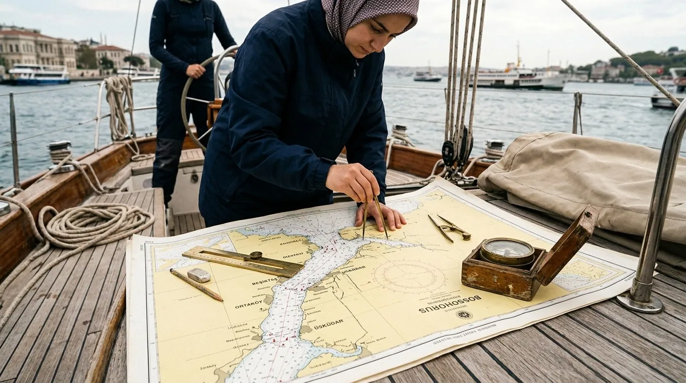
One idea sits at the heart of Turkish geography: a single country on both sides of a strait. The Asian part — the Anatolian plateau — is the greater body, while the small European strip (Eastern Thrace) is what makes Turkey geographically and politically a European player. The Bosphorus that divides them in Istanbul is a sea lane linking the Black Sea to the Sea of Marmara, then the Dardanelles to the Mediterranean — an international waterway crossed daily by tankers, ships and tourist cruises, governed by the Montreux Convention since 1936.
This position explains two things for visitors: why Istanbul was the capital of two empires (it commands the trade and military passage), and why Turkey changes so much as you move across its map — from the warm Mediterranean shores to the Anatolian plateaus to the eastern mountains.
Turkey's Headline Numbers
| Item | Figure |
|---|---|
| Total area | 783,562 km² |
| Population | About 85.4 million |
| Provinces | 81 |
| Geographic regions | 7 |
| Capital | Ankara — since 1923 |
| Largest city | Istanbul (about 15.6 million) |
| Latitude | 36°-42° north — roughly level with the Gulf |
| Time zone | A single GMT+3 zone — same as Saudi Arabia, no difference |
| Coastline | About 8,300 km with the islands |
Eight Neighbors and Four Seas
| Direction | Neighbor / sea |
|---|---|
| Northwest | Greece and Bulgaria — then the Aegean and the Sea of Marmara |
| North | The Black Sea — from Bulgaria to Georgia |
| Northeast | Georgia and Armenia |
| East | Azerbaijan (the Nakhchivan exclave) and Iran |
| Southeast and south | Iraq and Syria — then the Mediterranean |
| West | The Aegean facing Greece and its islands |
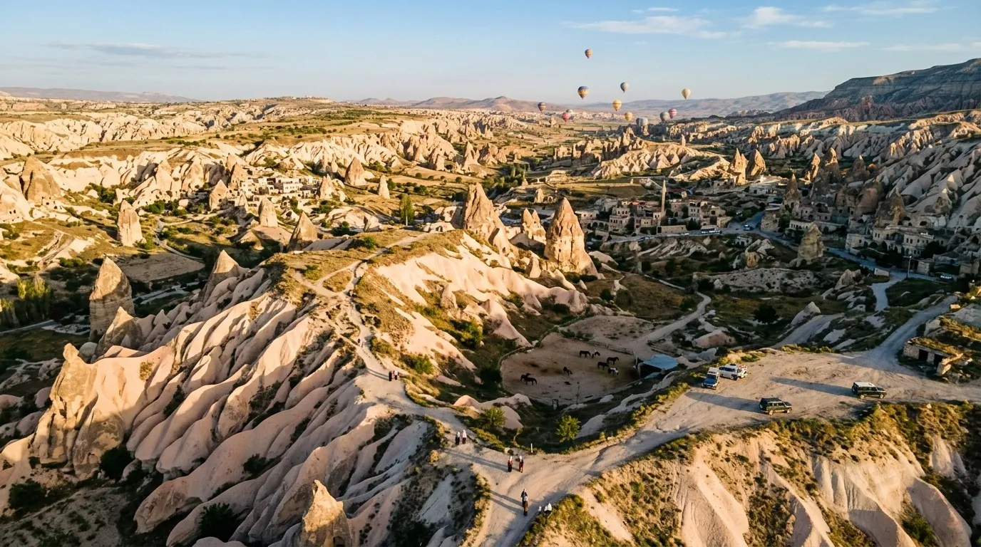
A practical note: all the big Gulf-favorite destinations (Istanbul, Trabzon, Antalya, Izmir) are coastal cities; Cappadocia, Konya and Ankara belong to the inland plateau — each pattern with different weather, summarized in the Turkey weather guide.
Straits and Islands: Details Your Trip Can Use
The Bosphorus (about 30 km) splits Istanbul itself: the public ferry from Eminonu is the city's cheapest and loveliest activity. The Dardanelles south of Marmara link it to the Mediterranean, carrying Canakkale and the history of Troy — a family-favorite day trip (Troy guide). The Princes' Islands in the Marmara are a summer pleasure by ferry from Istanbul.
Natural Geography Worth Knowing
- Mount Ararat (5,137 m): Turkey's highest peak in the far east — the mountain of the Noah's Ark story, with an ancient palace on its slopes.
- Lake Van: the country's largest lake, salty and soda-rich, turquoise in color, with a famous Armenian church on its island.
- The Kizilirmak (1,355 km): Turkey's longest river flowing entirely within its borders, emptying into the Black Sea.
- Pamukkale: the famous white calcite terraces of southwest Anatolia — Pamukkale guide.
- Mountain lakes: Uzungol in the North and Abant near Bolu — among the finest of the hidden gems.
The Seven Regions: Reading Your Trip's Map
| Region | Character | Most famous destination |
|---|---|---|
| Marmara | Both continents together | Istanbul and Bursa |
| Aegean | Coasts and antiquity | Izmir, Ephesus and Bodrum |
| Mediterranean | Beaches and resorts | Antalya and Kemer |
| Central Anatolia | Plateaus and depth | Cappadocia, Konya and Ankara |
| Black Sea | Endless green | Trabzon and Uzungol |
| Eastern Anatolia | Mountains and lakes | Van and Ararat |
| Southeastern Anatolia | Civilization and Mesopotamia | Mardin and Gaziantep |
The golden planning rule: two regions at most per trip — details in the 5-day itinerary and the city list in the Turkey cities guide.
Distances Gulf Visitors Actually Care About
| Route | Distance | In practice |
|---|---|---|
| Riyadh/Jeddah – Istanbul | About 3,000-3,300 km | 4-4.5 hours direct flight |
| Istanbul – Ankara | 450 km | One-hour flight or five-hour high-speed train |
| Istanbul – Trabzon | About 1,000 km | A 75-minute flight |
| Istanbul – Antalya | About 700 km | A 70-minute flight |
| Istanbul – Cappadocia | About 730 km | A 75-minute flight to Kayseri |
The lesson: Turkey's map is wider than it looks — a miniature continent; make domestic flights your friend and never squeeze three distant cities into one week.
Practical Info for Gulf Visitors
| Item | Detail |
|---|---|
| Maps and apps | Google Maps works excellently across Turkey |
| Domestic flights | A dense network linking the major cities — flight prices guide |
| Driving | On the right; long distances need a capable driver |
| Weather across regions | Big north/south differences — the MGM bulletin |
| Visa | E-visa for most Gulf nationals via evisa.gov.tr |
| Explore more | Official portal GoTürkiye |
Practical Basics for Navigating the Map
- Apps: Google Maps covers Turkey well and many travelers keep Yandex Maps as backup; download offline regions before long drives.
- Cash and ATMs: ATMs are everywhere in cities and rare between them — carry enough cash for intercity roads.
- Weather by region: you are on a miniature continent: the official MGM bulletin gives each region its own forecast before you pack.
- Visa: most Gulf citizens are visa-exempt for periods varying by nationality — confirm via the official evisa portal or the Turkey visa guide.
- Emergency and health: 112 is the unified nationwide emergency number (police, ambulance, fire); big provincial hospitals run round the clock.
- Connectivity: a local SIM or eSIM from day one — coverage is excellent on main intercity roads, patchy in rugged mountains.
Estimated Costs by Budget
Turkish-lira estimates per night, meal and transfer, rising in the summer peak:
| Item | Budget | Mid-range | Comfortable |
|---|---|---|---|
| Stay per night | 2,000-4,000 | 5,000-10,000 | 12,000-30,000 |
| Meal per person | 100-200 | 300-500 | 800-2,000 |
| Daily transport | 50-100 public | 1,500-3,000 car | 3,000-5,000 driver |
| Tour per person | 500-1,500 group | 2,500-5,000 private | 7,500-15,000 VIP |
Compare stays and programs via hotels and tours, and request a private transfer for family intercity routes.
How to Move Between the Map's Regions
On a map this wide, the means of transport is a travel decision in itself:
- Domestic flights: the first choice beyond 500 km; a dense network links Istanbul to every major destination, and early booking saves a lot — see the flight prices guide.
- High-speed trains (YHT): Istanbul to Ankara and Konya in comfort, with onward lines east — practical for the central corridor.
- Intercity buses: a vast, comfortable network reaching towns the train skips.
- Car with a driver: best for families over short hops (Trabzon to Ayder, Istanbul to Sapanca) — arrange via private transfer.
- Organized tours: they solve transport and programming together in Cappadocia and the North — browse tours.
The golden rule: fly the far, rail or bus the middle, drive the near — and never stack all three in one day with children.
Size Comparison: Numbers That Help the Mind
Absolute figures mean little until you set them beside what you know — this comparison makes Turkey's span tangible:
- Turkey is about a third of Saudi Arabia's area, larger than Germany and Britain combined, and roughly nine times the UAE.
- Its widest span, from the Aegean coast in the west to Mount Ararat in the east, runs about 1,600 km — farther than Riyadh to Jeddah.
- Despite this span, the whole country keeps a single time zone (GMT+3), so prayer schedules and calls home never shift.
Flight Times from Gulf Cities (Approximate)
| From | To Istanbul | To Trabzon | To Antalya |
|---|---|---|---|
| Riyadh | 4.5-5 hours | 5 hours | 4.5 hours |
| Jeddah | 4-4.5 hours | 4.5-5 hours | 4.5 hours |
| Dubai | 4.5-5 hours | 5 hours | 4.5-5 hours |
| Kuwait and Doha | 4-4.5 hours | 4.5 hours | 4 hours |
Most of these routes fly direct daily, and the summer season opens extra direct lines to Trabzon and Izmir — see the flight prices guide.
Across the Border: A Day Trip to Georgia
The Sarp crossing on the Black Sea coast sits about two and a half hours from Trabzon, and Gulf citizens normally enter Georgia visa-free (verify before you travel). Organized day tours leave Trabzon in the morning and return in the evening: a different beach and a different language in a single day — a favorite for families on longer programs.
Turkish Islands Worth the Map
- Gokceada (Imbros): Turkey's largest island, in the northern Aegean, with quiet beaches and Greek-flavored villages.
- Bozcaada (Tenedos): just to its south — a wine town of wooden houses that suits a romantic two days.
- The Princes' Islands: not one but nine islands in the Sea of Marmara, the closest an hour by ferry from Istanbul — details in the Istanbul guide.
The Time Map: How Many Days for Each Region?
Turkey's size is not about seeing everything, but choosing what fits your leave:
| Region | Comfortable duration | Suits |
|---|---|---|
| Istanbul & Marmara | 4-5 days | Every first-time family |
| Cappadocia & the center | 2-3 days | Balloons and history |
| Mediterranean (Antalya) | 4-7 days | Beach rest |
| Aegean (Izmir & Bodrum) | 3-4 days | Ruins and islands |
| Black Sea (Trabzon) | 3-4 days | Green and highlands |
| East & southeast | 3-4 days | Mardin and Van for depth lovers |
Gulf families' favorite pairings follow the two-region rule: Istanbul with Trabzon (city then green), Istanbul with Cappadocia for honeymoons, and Antalya with Cappadocia for sea plus valley — each joined by a one-to-1.5-hour domestic flight that is quicker and gentler than a six-hour drive with children. With ten days or more, a third region becomes realistic; in a single week, two is the honest maximum.
FAQ (12 Questions)
- Where exactly is Turkey? Between Europe and Asia: Anatolia is Asian and Thrace European, with the straits linking the Black Sea to the Mediterranean.
- What is Turkey's area? 783,562 km² — larger than nearly all its neighbors.
- How many provinces does it have? 81, of which Konya is the largest by area.
- Who are Turkey's neighbors? Eight: Greece, Bulgaria, Georgia, Armenia, Azerbaijan (Nakhchivan), Iran, Iraq and Syria.
- How many seas surround Turkey? Four: the Black Sea, the Sea of Marmara, the Aegean and the Mediterranean.
- What is Turkey's highest peak? Mount Ararat, 5,137 m, in the east.
- Its largest lake? Lake Van, 3,713 km², in the southeast.
- Its longest internal river? The Kizilirmak (Red River), 1,355 km.
- Is Istanbul European or Asian? Both — the Bosphorus splits it between two shores joined by two bridges and a tunnel.
- How far is the Turkish North from Istanbul? About 1,000 km — a 75-minute domestic flight.
- What is Turkey's population? About 85.4 million, more than 15 million of them in Istanbul alone.
- How do I plan a trip around the map? Two regions maximum per trip with a domestic flight between them — the ready-made model is the 5-day itinerary.
Conclusion
Turkey's map is a miniature continent: two continents, four seas, eight neighbors, seven regions and 81 provinces across 783 thousand square kilometers. Read it right and your trip makes sense: coasts for sea and rest, plateaus for history and balloons, the North for green — with distances settled by a domestic flight rather than a taxi. Make the map your first planning tool, and the rest is the pleasure of arranging.
Hotels across all Turkey's regions · Private transfer and intercity links · Tours between the regions
Sources
Related travel guides
Ayder highlands 5-day itinerary 2026: a day-by-day plan for Arab families covering thermal pools, valleys, and Trabzon.
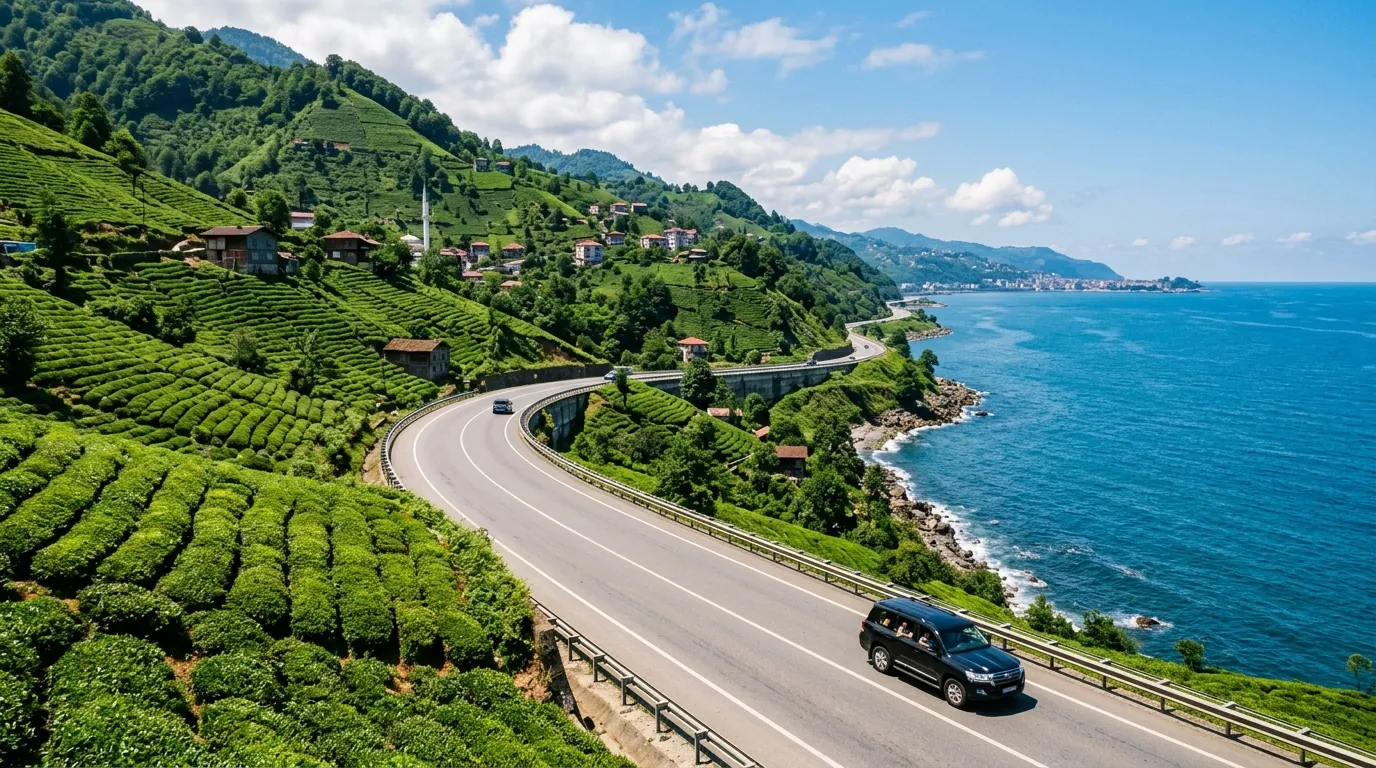
Ayder Trabzon distance 5-day itinerary 2026: a day-by-day plan for Arab families covering the transfer route.
Ayder Turkey weather 2026: monthly averages, rain patterns, best months to visit, and packing tips for Gulf families.
Ready to explore Turkey?
Voyago brings together hotels, tours and transfers to help you plan the perfect trip to Turkey.